Thursday the eleventh of July. We’d been on the road a week. This would prove to be a very tough desert transit, but one that would set us up for an easy ride the following day. We had Friday reservations at a campground in Mount Rainier National Park, so had to make good time if we wanted to do more than fall asleep in the lee of Mount Rainier. I elected to stay on I-90 to Missoula; we left Livingston, Montana, at five in the morning.
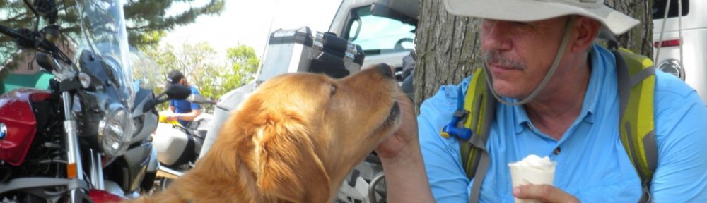
A stiff headwind started with the sunrise and gained strength throughout the day. That resulted in significant steering resistance; I had to muscle the handlebars all day and by the end of the ride had had a pretty good upper body workout! There were only a couple moments of levity on the road this day. The first came as a small Pontiac overtook us on the Interstate. The thirty-something African-American woman driver smiled at us as she slowly passed; in the back seat her kindergarten-age son waved frantically. I waved back and he went practically delirious with joy, high fiving himself as his mother laughed. The second came when a woman and her minivan full of girls – elementary through high school age – found us at a rest stop and gave Barley all the loving he could handle.


Past Missoula, the hills surrounding Lolo Pass gave us some protection from the incessant wind, but the legendary pass was a collection of construction zones, with chip seal being applied to fresh pavement. We lost over two hours waiting for pilot cars to escort us around the highway improvements, and the ride was hot, slow and extremely dusty. We took a few breaks in the nearby Lochsa River to shed excess body heat, but it was tough going. By the time we reached the Nez Perce Reservation in Idaho the temp had reached 99F and the scenery was unfailingly brown and dry. It was very strange to see such large rivers flowing freely through miles of dead terrain.

Another stretch of Interstate straight into the wind. At eighty miles per hour my mileage fell to an all time low of 19.3mpg. I suspect the additional sail area of Barley’s ragtop had a lot to do with it, but keeping him out of direct sunlight was worth it.
We pulled into the Roadway Inn at Sunnyside, Washington late in the afternoon. It was clean, had high-speed WiFi, plenty of ice, cold air conditioning and was close to food. While the night clerk was coldly efficient, her counterpart in the daytime was wonderfully friendly and simply adored Barley! She even got him to talk!
I woke up at five o’clock on Friday, but let Barley sleep late. The heat of the previous day had been tough on him, and though today would be a short day he had no way of knowing that. If I pushed him too hard it would stop being fun, and if the dog ain’t havin’ fun, ain’t nobody havin’ fun! We hit the road at seven, for the most part sticking to the speed limit. Washington and Idaho have very conservative speed laws. Wyoming and Montana set them much higher and allow drivers to select what they consider a reasonable speed, generally lower than the limit. Interestingly, I saw no difference in driving habits between those states. With a 75mph limit, drivers in Wyoming and Montana drove 70-75mph. With a 65mph limit, drivers in Washington and Idaho also drove 70-75mph, speed limit be damned.


We drove through terrain that was completely brown save for irrigated vineyards and groves of fruit trees, passed several fresh fruit stands that regrettably were not open at this hour, and caught our first glimpse of Mount Rainier before nine o’clock. After an hour of climbing through increasingly green and cool mountains we reached our destination: Ohanapecosh Campground. It was simply lovely!


I watered Barley and groomed him, gave him a treat and tucked him under the picnic table while I set up the tent. Inside went my insulated pad and sleeping bag. When I returned with Barley’s memory foam mattress I found him curled up and sound asleep on my bag. Exhausted, I curled up on his mattress and napped next to him. A couple hours later we woke up and took a short walk around the campground to stretch our legs. We noticed three young women on their hands and knees washing their exceptionally long hair in ice cold spring water. The spigot was only a foot off the ground, not high enough to keep their hair from dragging in the dirt. Each golden mane was a tangled mess of leaves, dirt and small pine cones. Nearby were several buckets meant for carrying water to drown campfires. I pointed to them. “Why don’t you use the buckets to rinse each other?”
The looks they gave me told me they clearly had the situation under control. We moved on.

Ohanapecosh was a very nice, peaceful campground. Sounds of nature surrounded us, punctuated now and then by the lingering sounds of loud pipes on cruisers and the occasional big bore pickup truck. I had stubbornly resisted changing out of my hot weather mesh riding gear after entering the park, and as a result was chilled to the bone. With patches of snow here and there, the tree-shaded campground was cold after the desert! I was grateful for the layers of clothing I’d brought, but worried about keeping both of us warm overnight.

With our campsite nicely organized, we walked toward the sound of running water. Reaching the river, I was stunned by how clear and blue the water was! A nearby sign explained that rivers fed by snowmelt, like the one we stood before, were crystal clear while those fed by glaciers were milky-white from sediment created as the glacier ground over the land beneath.

At six o’clock a truck bearing firewood made its rounds. I bought two bundles and quickly got a warming fire going. I fed Barley, after which he curled up near the fire and fell asleep…until he noticed me preparing my own food. I had carried a military MRE (Meal Ready to Eat) for the past four years for emergencies and decided this was a good day to see how it compared to the old C-Rations of my era. The packet contained a foil pouch of minestrone stew, another containing a chicken filet, a plastic-wrapped petroleum-based pseudo-fudge brownie, and a condiment pack. The gum, matches and toilet paper were unchanged from my generation. The gum was still rock hard. A moist towelette had been added – a nice touch. There was no coffee, but there was sodium-free seasoning, cocoa, iced tea and apple cider. And M&Ms reduced to chocolate powder with colorful flecks.
But the taste of it all was only a marginal improvement over C-Rations.
Darkness fell as did the temperature. I slipped into my summerweight sleeping bag and pulled Barley close, then covered us both with a military-surplus insulated poncho linger. It was plenty warm.
We woke up at five the next morning, but the campground did not. I started another warming fire with the last of the wood, got my JetBoil stove going for the morning oatmeal, and started breaking camp. We ate breakfast together, Barley and me, then packed the rig and drowned the fire. By seven o’clock we were riding up Stevens Canyon Road toward Paradise, Washington.

The road was bordered by dense forest, but there were places where the road followed the edge of a cliff that offered fantastic views. We saw many hikers and climbers, in fact, nearly every pullout was choked with the cars of people out on the trails. It was one of the things that really impressed me about the Pacific Northwest; folks don’t just look at the scenery, they go out and experience it!

Rainier up close was surreal! Broad-shouldered and majestic, its slopes still covered with deep snow crisscrossed with ski and snowshoe tracks, it towered over everything within sight. We continued down Stevens Canyon Road to the town of Elbe, then turned south bound for the east side of Mount St Helens. The road was fun and fairly technical in places, requiring a lot of body English from both Barley and me on some of the curves. But the forest is close to the road, and the trees very tall, so there wasn’t much in the way of scenery. As we climbed higher I began noticing tree tops snapped off, just the portion of trees that rose above the crest. Then we rounded one last curve and stopped…

Nearly every tree has been laid flat, their desiccated trunks bleached by the sun. Those that remained upright were nothing but spikes reaching toward the sky. Shrubs and a very few small trees struggled to survive in the nutrient-poor volcanic ash that covered everything. We pulled into a parking lot at a scenic overlook to read a Forest Service sign. It took me a few seconds to realize that the large grayish flat area in the valley below was the dead remains of Spirit Lake, still choked with floating logs thirty-two years after the eruption!


To our left was Mt St Helens, an ugly, malevolent volcano missing the side facing us.

Retracing our path, we left the forest and turned south, then southeast along some dirt logging roads. It was hot and dry, and we raised a huge cloud of dust behind us. I slowed down to lessen the dust for any hiker or mountain biker we passed, and by the time we reached the small town of Trout Lake it was miserably hot. The Grange Hall was serving Mexican food as a fund raiser, so we stopped for lunch. Raised in the southwest, I’ve always loved Mexican food. When I moved to Vermont a couple decades ago I was dismayed to read that Taco Bell had won the award for Best Ethnic Food two years in a row! While that situation has improved somewhat over the years, I rarely pass up an opportunity to sample the real thing.


We continued south, and if anything it became even hotter and drier as we neared the Columbia River Gorge. Again I was struck by the incongruity of a massive river in the midst of brown, lifeless land. We crossed the mighty Columbia on the Bridge of the Gods, paid our toll, then turned left and rode Historic Highway 30 to The Dalles, Oregon where it was so incredibly hot we turned right around and headed back to Hood River. Unfortunately, Hood River is a tourist town and had several events happening that weekend. Too hot to camp, I found only one hotel room available within fifty miles. It’s a suite with a built-in Jacuzzi, and way more than I wanted to spend, but it was also the only room in town. I plopped down the credit card and offered Barley first shot at the Jacuzzi, but he was overheated and simply lay down in front of the air conditioner.