Google Maps came through in the end…
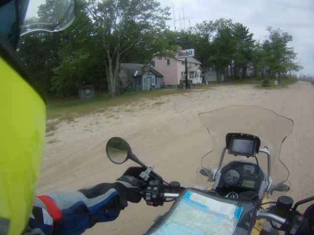
Remember how I mentioned that there were only a couple of routes I had planned on following during this year’s ride? Well, this was one of them. I had painstakingly examined satellite photos of the area, using Google Earth to zoom in and find roads off the beaten path. Over the next two days I would discover the hard way that Google Earth does not differentiate between paved roads and goat tracks!
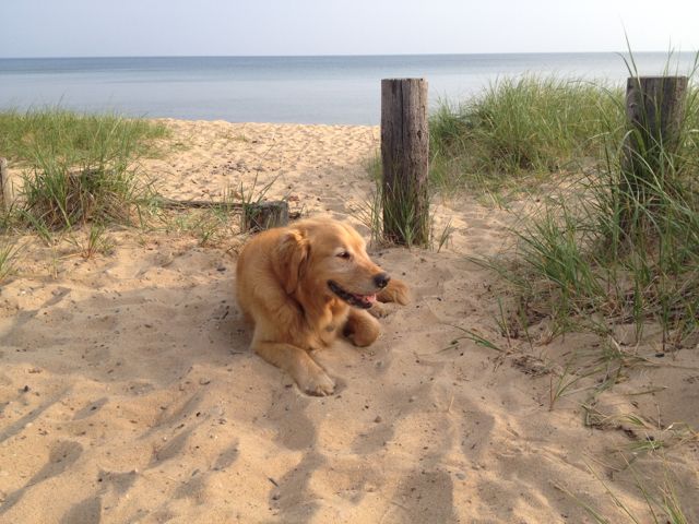
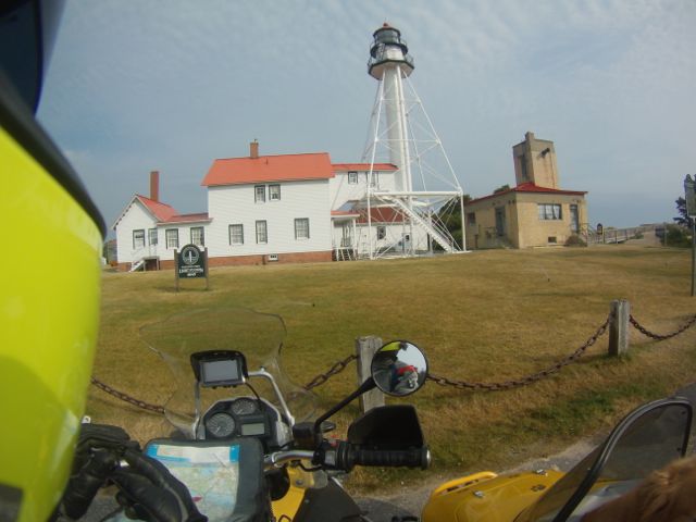
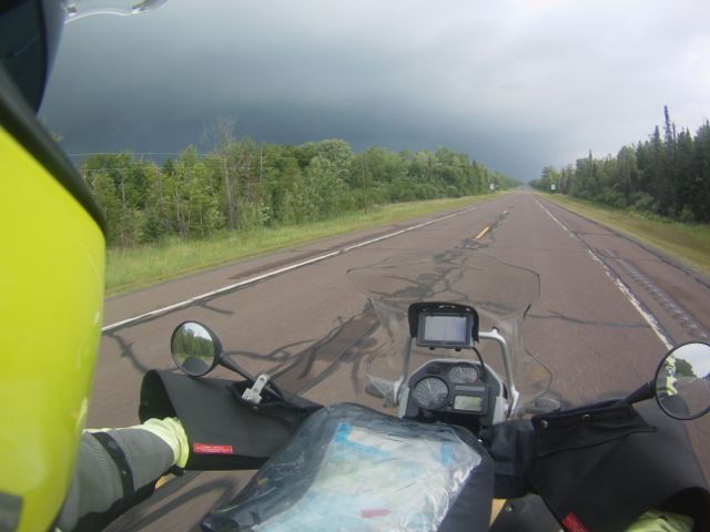
The day started out innocently enough. We traversed a very flat, very straight section between Lakes Michigan and Superior on pavement, then followed the shoreline past Paradise and up to the lighthouse at Whitefish Point. The museum wasn’t open at that early hour so we played on the sandy beach for a bit, snacked next to a massive old anchor, then saddled up and returned to Paradise before angling west, then leaving the pavement on a wide and well-maintained dirt road.
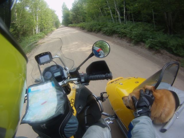
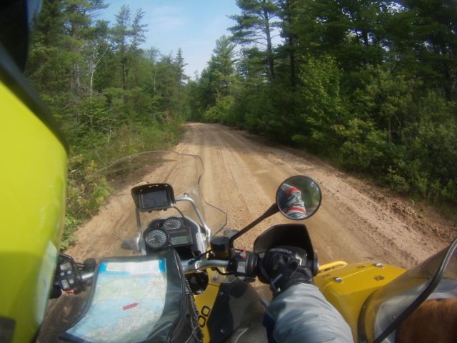
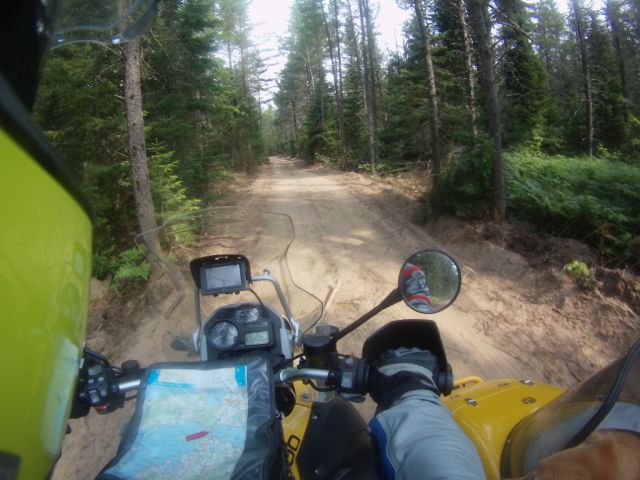
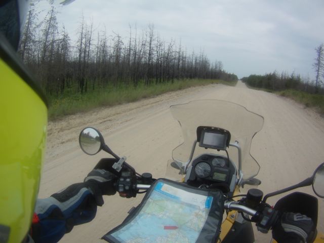
But that road turned into a smaller road, which became a tiny road, which became a logging road on which we had to maneuver around stumps. At some point it turned into a trail and then what could best be described as a goat path. I didn’t dare roll off the throttle for fear of getting stuck, but the big GS Adventure muscled its way through deep sand, over whoop-de-doos, and through some deep puddles and pretty significant mud that splashed up and covered my helmet cam, rendering it blind. I saw no signs of recent human activity and wondered, if we got stuck out there, if Barley would be good enough to share with me whatever rodents he managed to find.
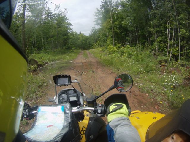


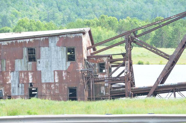
The goat path eventually became a trail, then a logging road, then narrow dirt roads on which I could see the tracks of other vehicles. We began seeing four wheel drive trucks nestled next to small ponds, fisherfolk trying their luck in the tannin-stained water. The road widened some more, still not well-maintained, and we eventually found ourselves at an abandoned gas station. Beyond it was evidence of a not-too-distant fire. Miles and miles of dead, blackened pines reaching to the cloudy sky above.


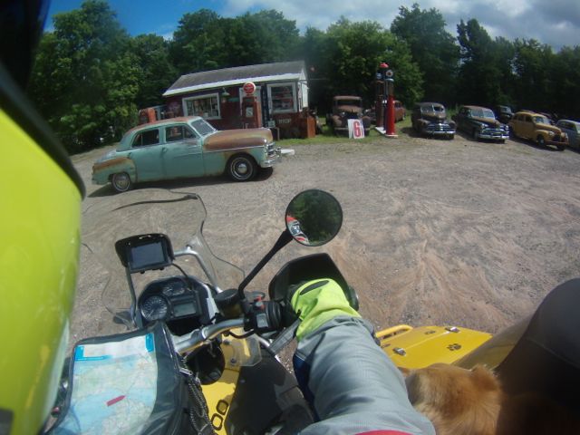
The GPS screen had been blank for the past couple of hours, showing nothing more than a motorcycle icon in the midst of a pale green screen, but the directions it sent to my Bluetooth headset proved to be spot on, assuming one had faith in the unit, that is. “Navigate off road. In 300 yards, turn half left and continue navigating offroad,” did not fill me with much hope of finding civilization at first, but time after time I would find a place to turn where instructed. And so we found ourselves raising a huge plume of powder on a smooth dirt road at sixty miles per hour, the GPS assuring us that there was, in fact, a small town ahead.
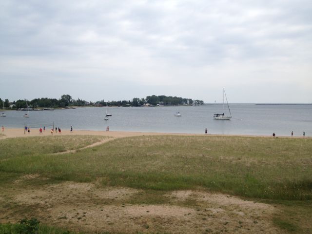
The town was Grand Marais, built along the shore of a small sheltered cove of that greatest of all the Great Lakes, Superior. I pulled over at a cove side picnic area for a stretch break. Barley does not enjoy the often violent ride that offroad entails, so some downtime to let him recover, and to forgive me, was called for. There was a restaurant nearby, so we grabbed lunch and brought it back to the shoreline to share before pressing on.

Michigan H-58, following the southern shore of Superior from Grand Marais to Munising, had recently been paved. I wish I’d had the chance to ride it while the route was still dirt, because many simply turn around when the pavement ends. Dirt roads mean solitude. Still, it was a scenic ride; with Barley and I enjoying breaks on several side roads along the way. I took several photos of the magnificent cliffs of Pictured Rocks National Lakeshore, discovering two days later that the SD card in the Nikon was defective. Bummer – but an excuse to revisit the area another year!
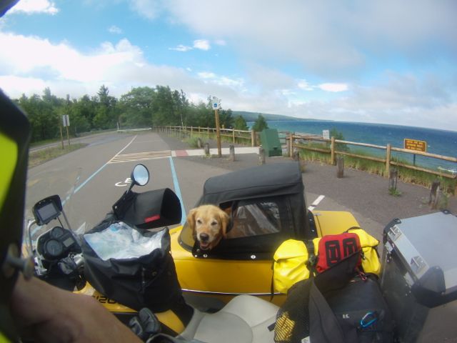
We left the shore at Munising, heading overland directly west to Marquette, where I pulled over to don rain gear against the gentle showers that considerately washed the dirt and bugs off our rig. We continued west to L’Anse before turning north toward the very scenic Keweenaw Peninsula. The sun came out, promising fair weather ahead, and I pulled over to remove my rain gear. That turned out to be a very bad decision! Less than ten minutes later, my side visibility limited by tall trees flanking the road, the wind picked up dramatically and the sky suddenly turned a sinister black punctuated by lightning bolts!
I pulled over immediately and raised the lid of the sidecar and bid Barley to dismount so I could retrieve the raingear stowed under his mattress. It wasn’t till I ordered him back into the hack that I realized how seriously screwed I was. In the process of shaping each other into a cohesive, long distance riding team, we had developed a routine. Part of that routine was that once he dismounted, Barley was allowed a minimum of five minutes to pee and stretch before we pressed on. The fact that a wall of torrential rain had caught us in the open made absolutely no impression on him. In seconds everything that was not protected by waterproof bags – including myself – was completely soaked. Nonplussed, Barley dug a pit under a fallen log in search of rodent snacks.
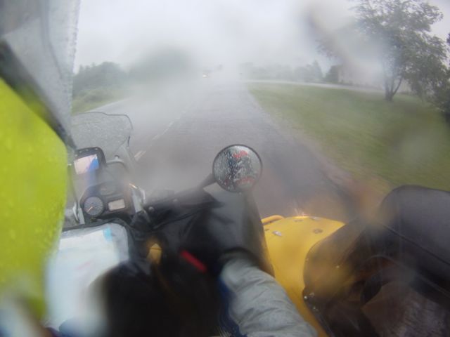

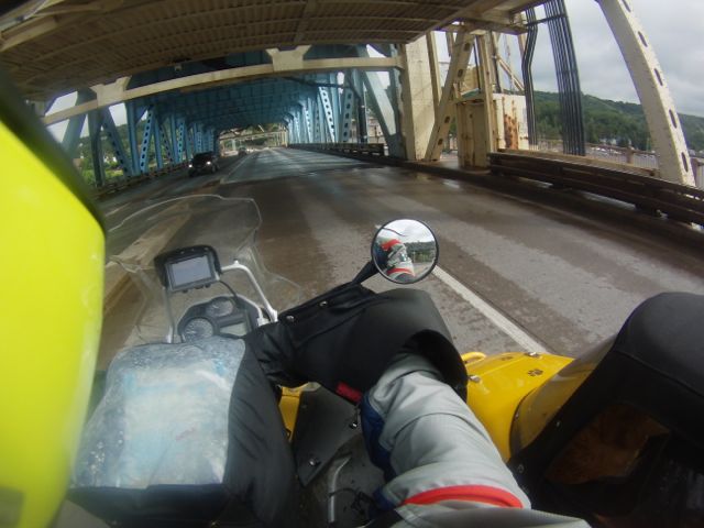
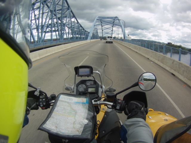
Already soaked, I gave up on the rain gear and waited for Barley’s play time to end. With his muzzle mud-rimed, he grinned at me from his soaking wet bed. With a sullen hrumph, I closed the hatch and pressed on. Ten minutes later, as if to rub salt in my wounds, the sun came out though the wind continued unabated. We crossed Houghton Bridge, the world’s heaviest and widest double-decked vertical-lift bridge, and set out on a meandering (and very cold) journey to the tip of the Keweenaw.
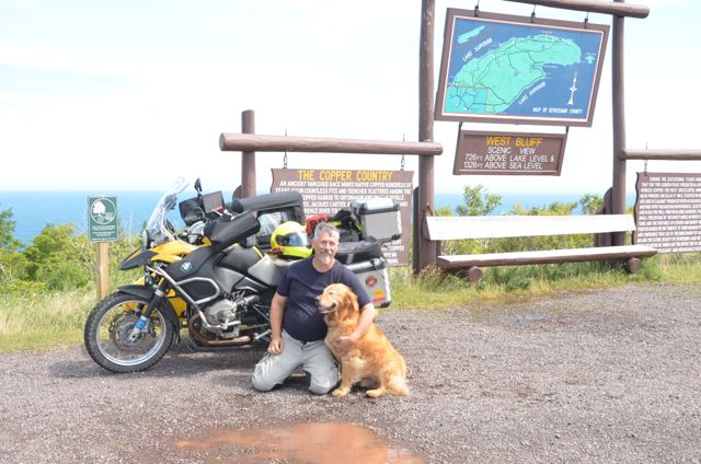
Near the town of Copper Harbor we rode to the top of Brockway Mountain. The trip up was sheltered by treed slopes, and it wasn’t till we reached the summit that the full force of the wind hit us. I parked with the sidecar downwind for stability, and struggled to raise the lid so Barley could get out. A few feet away a full dress Harley was blown off its sidestand and crashed to the ground; I helped the couple right their bike. By way of thanks they snapped a photo of my dog and me. We shouted unintelligibly, then gave up, laughed at the wind, and waved our goodbyes.
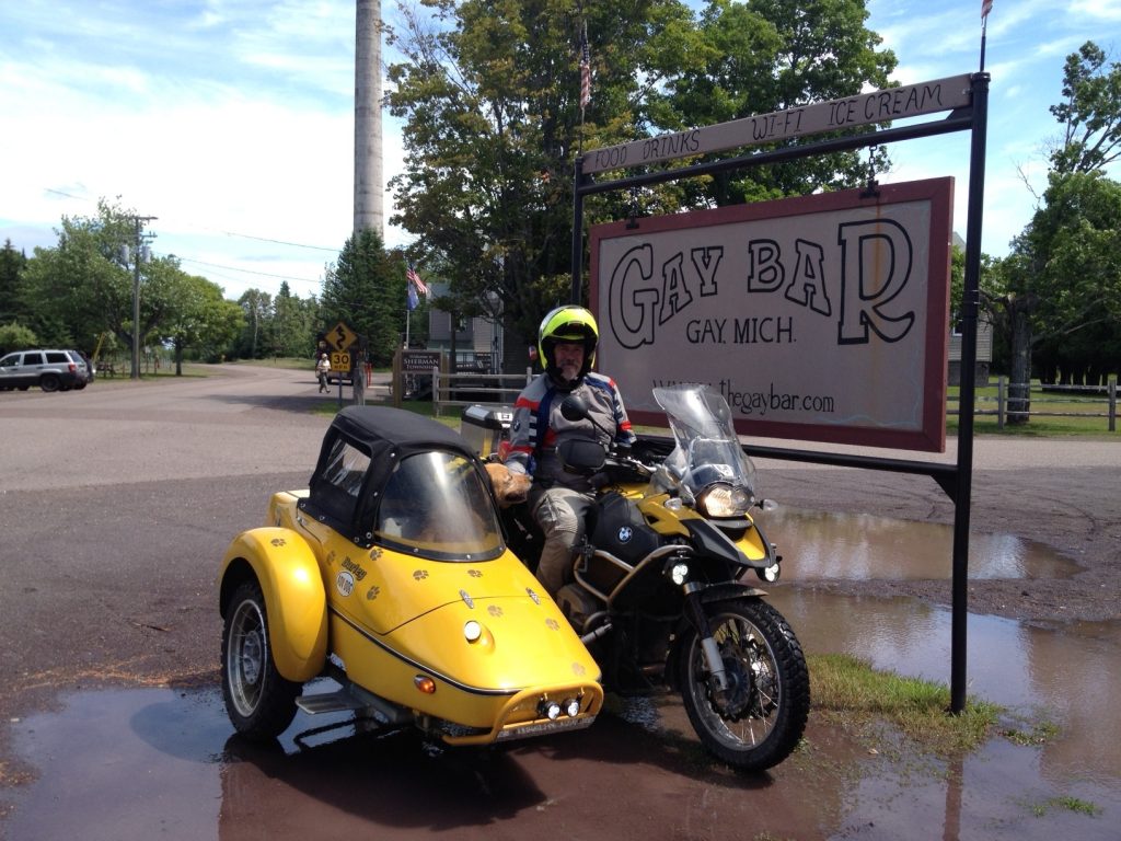
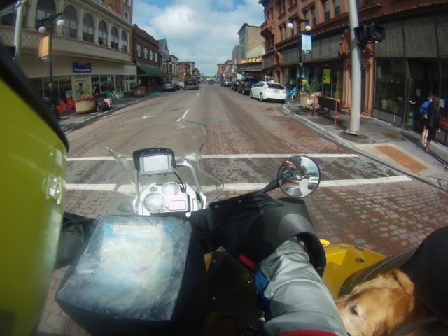
Back down the mountain we rode, turning south on Highway 41 at Copper Harbor. We were doing 45mph, but the shadows of the clouds overhead passed us at a much higher rate of speed. And in my damp gear it was cold! To get out of the buffeting I turned east on an unmarked dirt road and headed for the town of Gay, which was sheltered by the bulk of the peninsula. Barley and I had an early dinner in The Gay Bar before returning to the town of Houghton, finding a warm, dry hotel, and settling in for the night.
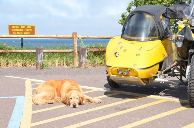
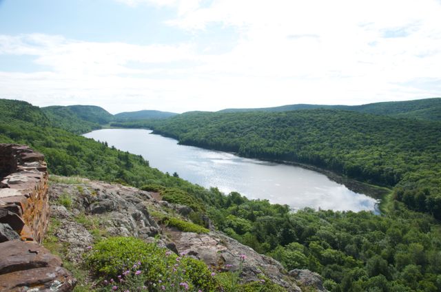
In the morning we moved south and west as roads permitted, till we reached the coastline again, this time at Ontonagon. We followed the coastline to the Porcupine Mountains, visited Lake of the Clouds where Barley delighted a minibus of pre-teens with Down’s Syndrome. Their joy in finding a dog to hug was heartwarming!
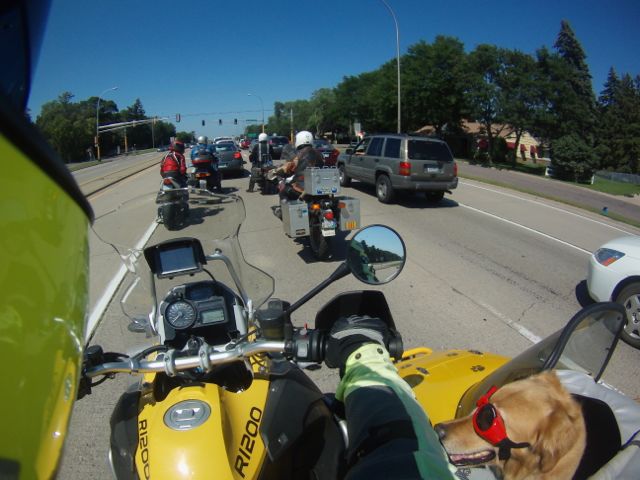
We soon crossed into rural Wisconsin, making excellent time on a mix of paved and dirt roads, crossed the Mississippi River into Minnesota, and followed an increasing number of other Beemers to the state fairgrounds, site of the 2014 BMW MOA International Rally.